新的无人机技术现在可用于应急情况的辐射监测

在核事故例如2011年福岛第一核电站事故发生后,反应堆附近受辐射污染的区域可能过于危险,人们无法进入该区域监测辐射。国际原子能机构为日本福岛县当局开发的一项使用无人机的新技术将使这项任务变得更容易。

国际原子能机构为日本福岛县当局开发的一项使用无人机的新技术可以在受污染地区进行放射性测量。(图/福岛县)

在核事故例如2011年福岛第一核电站事故发生后,反应堆附近受辐射污染的区域可能过于危险,人们无法进入该区域监测辐射。国际原子能机构为日本福岛县当局开发的一项使用无人机的新技术将使这项任务变得更容易。

原子能机构为配备辐射探测器、照相机和GPS装置的无人机开发的方法和仪器已在福岛县的实际状况下进行了测试和验证,目前可在日常或应急情况下实际使用。根据这一经验,原子能机构随时准备协助有关成员国开发和实施用于核或辐射应急后的放射性测绘技术。

无人机成本低和避免人类受到辐射照射,是这项技术的两大显著优势。

原子能机构和福岛县于2012年首次开始合作开发和使用无人机进行辐射监测。在原子能机构“核安全行动计划”的框架内,原子能机构已通过2012年至2020年的连续两个项目向福岛县提供了援助,具体方式包括:

• 提供一套完整的基于无人机辐射测量仪器系统,一套具有数据处理和存储能力的辐射探测系统,由原子能机构核科学和仪器仪表实验室开发和建造;

• 提供测量后分析和解读方法,并在福岛县和奥地利塞伯斯多夫核科学和仪器仪表实验室对人员进行无人机及其仪器仪表系统应用以及使用软件获取和解读数据的培训。

最近,无人机技术取得了突破性进展,预计在不久的将来会有重大发展,包括更大的有效载荷、集成探测器和传感器、改进的自导航以及车辆与其他无人机以及地面系统协同工作的能力。原子能机构目前正在进行新的改进仪器的集成和测试,包括为适应下一代无人机进行的改装。

“这些新的发展既可延长无人机的飞行时间,又可通过一次测量确定剂量当量率和伽马能谱。”原子能机构物理处处长Danas Ridikas说,“新系统在与高质量的相机功能结合时,将使用户获得与放射性地图和放射性核素识别相叠加的完整三维航空摄影测量模型。”

原子能机构辐射安全和监测处处长Miroslav Pinak解释说,基于无人机的技术将对推进辐射监测包括加强环境测绘的应用和改进对污染地区的长期监测至关重要。

利用原子能机构开发的无人机系统收集并经福岛县验证的数据,可用于评估潜在的辐射风险,并有助于日本制定适当的治理、去污和核废物管理计划和战略。

原子能机构将公开提供一份关于项目成果的详细技术文件,包括仪器仪表校准、方法验证、原位剂量率测量和福岛县放射性废物临时贮存点的测绘。

这些技术、方法和相关培训机会可应请求提供给原子能机构成员国,并已在原子能机构的支持下在一些国家实施。

3d-aerial-photogrammetry-1140x640.jpg

与使用单一无人机在连续两次飞行中获得的放射性地图相叠加的完整三维航空摄影测量图。(图/国际原子能机构和福岛县)

这项技术是如何工作的?

无人机配备了辐射探测器、照相机和GPS装置。无人机起飞后,辐射读数和其他相关信息将与其精确的GPS位置同步,并实时发送给地面站的飞行员,同时也存储在机上。着陆后,所有的详细数据被恢复,照片和地理信息与修正后的辐射测量值一起被重建。这些卫星照片和经过分析的辐射测量数据随后可提供给决策者,用于采取进一步行动。

in-situ-measurements1-1140x640.jpg

in-situ-measurements2-1140x640.jpg

.

Recently there has been breakthrough advances in UAVs and major developments are expected in the near future, including larger payloads, integrated detectors and sensors, improved self-navigation and the ability for the vehicles to work in cooperation with other UAVs as well as ground systems. The IAEA is currently working on the integration and testing of new, improved instrumentation, including its adaptation to the next generation of UAVs. 

“These novel developments will allow both longer flight time of the UAV and determination of the dose equivalent rates and gamma spectra in a single measurement,” said Danas Ridikas, Head of the IAEA Physics Section. “When combined with high quality camera capabilities, the new system will allow obtaining a full 3D aerial photogrammetry model superimposed with the radiological maps and radionuclide identification.”

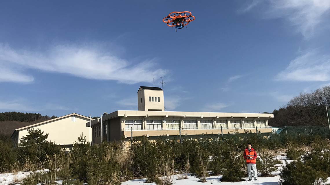
UAV-based technologies will be crucial for advancing radiation monitoring, including enhancing the application of environmental mapping and improving long-term monitoring of contaminated areas, explained Miroslav Pinak, Head of the IAEA Radiation Safety and Monitoring Section.

The data collected using the UAV systems developed by the IAEA and validated by Fukushima Prefecture can be used to assess potential radiation risks and help establish appropriate remediation, decontamination and nuclear waste management plans and strategies in Japan.

A detailed IAEA technical document of the project results, including instrumentation calibration, methodology validation, in-situ dose rate measurements and mapping of the radioactive waste temporary storage sites in Fukushima Prefecture will be made available publically.

The developed technology, methodology and training opportunities are available to IAEA Member States upon request and are already being implemented in some countries with the Agency’s support.

3d-aerial-photogrammetry-1140x640.jpg

Full 3D aerial photogrammetry superimposed with a radiological map obtained using a single UAV in two consecutive flights. (Image: IAEA and Fukushima Prefecture)

How does the technology work?

The UAVs are equipped with radiation detectors, cameras and GPS devices. After the UAV takes off, radiation readings and other relevant information are synchronized with exact GPS position and sent in real time to the pilot at the ground station and stored onboard. After landing, all detailed data is recovered, which means that the photographic/geographic information is reconstructed together with the corrected data of the radiation measurements. The satellite-like photographs and the analysed radiation data measurements are then made available to decision-makers for further action.

in-situ-measurements1-1140x640.jpg

in-situ-measurements2-1140x640.jpg

Example of in-situ measurements (not-corrected raw data) performed in the area accessible both for backpack and UAV techniques: data points obtained with the UAV system (Geiger-Müller counter) flying at 10m altitude (on the left); data points obtained with backpack system (CsI spectrometer) walking throughout the area with the detector located at 1m altitude (on the right). (Photos: the Fukushima Prefecture)

相关资源